

Developed predominantly during the 18th century whaling industry, Nantucket’s historic downtown embodies resilience and preservation. As the heart of the Island, town is filled with historic sites, cobblestone streets, and flocks of tourists during the height of the season. In 1966, the area was listed on the National Register of Historic Places along with the village of Siasconset. In 1975, that designation was expanded to include the entire island.
The Downtown Study Area encompasses Easy Street, the bottom of Main Street, and Candle Street running from Steamboat Wharf, one of two major transportation piers, to Commercial Wharf. It serves as the primary commercial and transportation center in the downtown area. The island’s two ferry services offering transit to the mainland, Steamship Authority and Hy-Line Cruises, operate out of Steamboat Wharf and Straight Wharf, respectively. The Easy Street corridor sits within this study area and is another one of the Island’s most vulnerable to flooding and storm damage.
Historic Downtown Nantucket: As the Whaling capital of the world from the 1700s through the 1830s, Nantucket Harbor served as the epicenter of whaling ships coming and going, preparing for months-long journeys at sea and welcoming them back after a long voyage. At the height of the whaling industry, the harbor was home to 150 whaling ships. The rest of downtown Nantucket was filled with numerous candle factories and warehouses churning out a product that would be shipped around the globe. Many of these warehouses, as well as 250 buildings, were destroyed during the fire of 1846.

View from tower or roof of Straight Wharf, Steamboat Wharf, and Brant Point 1885. Courtesy of the Nantucket Historical Association, PH170

The Thomas Macy warehouse on Straight Wharf, at the time occupied by the Kenneth Taylor Galleries, sponsored by the Nantucket Foundation. On the left is Cormie's Blacksmith Shop, and a small building at 10 Straight Wharf. On the right is the Straight Wharf Theatre. Courtesy of the Nantucket Historical Association, P10350

Easy Street boat basin flooded, showing Easy Street and Old North Wharf under water. 1930s (Courtesy of the Nantucket Historical Association, F1897).

Aerial view overlooking Nantucket town, wharves, and the waterfront before renovation. May 1968 (Courtesy of the Nantucket Historical Association, P10706).

Extreme high tide, winter of 1978, causes a flood in downtown Nantucket. Young's Bicycle Shop on Broad Street visible (Courtesy of the Nantucket Historical Association, P21645).

Straight Wharf Theatre, and the Thomas Macy warehouse 1968. Courtesy of the Nantucket Historical Association, P11616

View of Straight Wharf Marina from Old South Wharf 1950s. Courtesy of the Nantucket Historical Association, P11445

Flood in downtown Nantucket. This is the former Dreamland parking lot and north side of the rear of the Dreamland with several inches of standing water. 1970s (Courtesy of the Nantucket Historical Association, P21831).

High tide on Broad Street at the corner of Steamboat Wharf and South Beach Street January 1987 (Courtesy of the Nantucket Historical Association, P8796).

Straight wharf, showing the Wauwinet Boat house, and Old South Wharf, showing Island Service Company building, and many boats July 26, 1939. Courtesy of the Nantucket Historical Association, A59

Flood high tide at Steamboat Wharf, with a storm warning signal flag just visible on the Coast Guard tower in the background. The white building is the Skipper Restaurant. 1970s (Courtesy of the Nantucket Historical Association, P21829).

Postcard of New Mall and Parking Area at Straight Wharf, 1970_80s. Courtesy of the Nantucket Historical Association, PH164

View of Harbor Square on Straight Wharf, with view of La Crepe, Captain Tobey's Chowder House, and Straight Wharf Theatre. The red brick building next to the theatre is the Thomas Macy warehouse then the home of the Kenneth Taylor art gallery. The brighter red brick building in the background is the Pacific Club 1970s. Courtesy of the Nantucket Historical Association, PH71-3-12.

Snapshot showing storm damage taken at the end of Straight Wharf 1940s (Courtesy of the Nantucket Historical Association, P19243).

"No Name Storm" of November 1991, crashing on the bulkhead at the Yacht Club, with Steamboat Wharf in the background (Courtesy of the Nantucket Historical Association, P22493 ).

The Thomas H. Macy House and the homes known as the 'three bricks' reflect the Federal and Greek Revival styles, respectively, popular along Main Street. (Courtesy of the Nantucket Historical Association, F2200).
Downtown Nantucket: Following the decline of the whaling industry in the 1880s, Nantucket pivoted to a tourism economy and has continued as such ever since. People from around the world are drawn to the natural beauty and magic of Nantucket’s harbor and the historic cobblestone streets filled with boutiques, coffee shops, and renowned eateries. There is hardly a quiet moment in downtown Nantucket during peak season. From April through October, the streets are bustling with seasonal residents, day visitors, seasonal industry employees, and local shop and restaurant owners alike.

Straight Wharf featuring oyster bar Cru

The outskirts of downtown Nantucket

The Shanty_ a carriage house turned scallop shanty, restored into a modern renewable energy and electric vehicle (EV) showroom

View from roof of Whaling Museum_ Looking over the yacht club to trucks boarding the Steamship vessel

A calm morning in the harbor

Shops and boats line Old South Wharf

Easy Street Basin looking at the Steamship ferry loading up
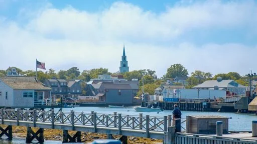
North Wharf with the Church in the background

A bustling Straight Wharf in the height of the summer

A rare sighting_ an empty street at the top of Main Street in the middle of July

Downtown

Easy street elevated storefront entrance due to flooding.

Main street downtown
